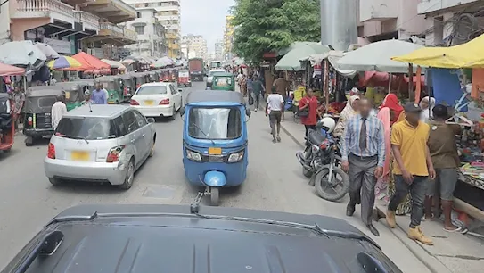
Empowering local communities in Zanzibar
Together with the Zanzibar government, photographers from WT360 set out to capture the streets of Zanzibar in 360 and teach the local community how to update their Street View.
Watch the film

Communities around the world are telling their stories through Street View
-
Empowering local communities with Street View
In 2019, a group of photographers started mapping Zanzibar. Learn more about the project's impact on tourism and the local economy.
-
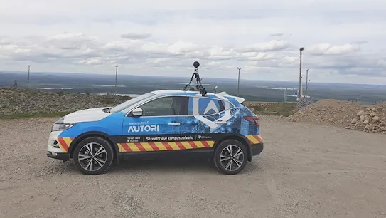
Autori revolutionizes road maintenance in Finland
A Finnish software company found a way to collect and analyze street-level data more efficiently with Street View.
-
All-terrain vehicles capturing the islands of French Polynesia
A local photographer got creative using golf carts, jet skis and horses to bring imagery of French Polynesia to the map and help local first responders improve their services.
-
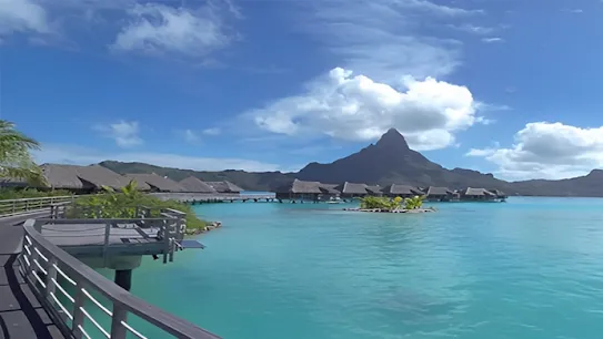
Digitally mapping the beauty of Bhutan to promote local tourism
Bhutan's Ministry of Tourism partnered with Google to open the gates of their Buddhist kingdom to the world.
-
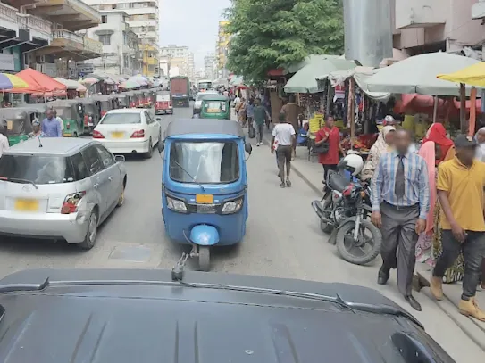
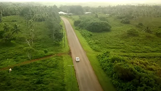
Laying the groundwork to map Zanzibar
The government teamed up with WT360 to map the country, educate locals on Street View, and empower them to continue the project.
-
Digitizing Myanmar and preserving it’s cultural heritage
Explore how a virtual reality production company started digitizing Myanmar with Street View to preserve the country's cultural heritage.
-
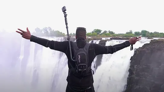
Mapping Zimbabwe by car, bike and boat
Tawanda Kanhema is mapping his country. Learn more about how he captured imagery of Victoria Falls and how he's bringing even more locations to Street View.
-
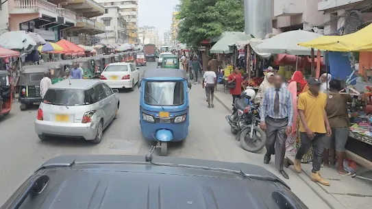
Local Guides are bringing Kenya’s beauty to the world
Local Guides and professional photographers teamed up to map Kenya and bring its beauty to the world. Learn more about their journey.
-
Overcoming obstacles when mapping Armenia
Joe Hacobian chronicles the ups and downs of mapping Armenia at the Google Maps Street View summit.
-
Boosting Bermuda's tourism
The Bermuda Tourism Authority and Miles Partnership joined forces to optimize Bermuda's online presence, boost local business discovery, and help tourists plan their travel.
-
Showcasing Tonga’s culture
To highlight the culture of Tonga and other Pacific islands, the Grid Pacific founders embarked on an ambitious plan to map the entire archipelago and add it to Street View.


-
Digitizing Myanmar and preserving it’s cultural heritage
Explore how a virtual reality production company started digitizing Myanmar with Street View to preserve the country's cultural heritage.
-
All-terrain vehicles capturing the islands of French Polynesia
A local photographer got creative using golf carts, jet skis and horses to bring imagery of French Polynesia to the map and help local first responders improve their services.
-
Digitally mapping the beauty of Bhutan to promote local tourism
Bhutan's Ministry of Tourism partnered with Google to open the gates of their Buddhist kingdom to the world.
-
Empowering local communities with Street View
In 2019, a group of photographers started mapping Zanzibar. Learn more about the project's impact on tourism and the local economy.
-
Laying the groundwork to map Zanzibar
The government teamed up with WT360 to map the country, educate locals on Street View, and empower them to continue the project.
-
Autori revolutionizes road maintenance in Finland
A Finnish software company found a way to collect and analyze street-level data more efficiently with Street View.
-
Mapping Zimbabwe by car, bike and boat
Tawanda Kanhema is mapping his country. Learn more about how he captured imagery of Victoria Falls and how he's bringing even more locations to Street View.
-
Local Guides are bringing Kenya’s beauty to the world
Local Guides and professional photographers teamed up to map Kenya and bring its beauty to the world. Learn more about their journey.
-
Overcoming obstacles when mapping Armenia
Joe Hacobian chronicles the ups and downs of mapping Armenia at the Google Maps Street View summit.
-
Showcasing Tonga’s culture
To highlight the culture of Tonga and other Pacific islands, the Grid Pacific founders embarked on an ambitious plan to map the entire archipelago and add it to Street View.

-
Overcoming obstacles when mapping Armenia
Joe Hacobian chronicles the ups and downs of mapping Armenia at the Google Maps Street View summit.
-
All-terrain vehicles capturing the islands of French Polynesia
A local photographer got creative using golf carts, jet skis and horses to bring imagery of French Polynesia to the map and help local first responders improve their services.
-
Laying the groundwork to map Zanzibar
The government teamed up with WT360 to map the country, educate locals on Street View, and empower them to continue the project.
-
Empowering local communities with Street View
In 2019, a group of photographers started mapping Zanzibar. Learn more about the project's impact on tourism and the local economy.
-
Mapping Zimbabwe by car, bike and boat
Tawanda Kanhema is mapping his country. Learn more about how he captured imagery of Victoria Falls and how he's bringing even more locations to Street View.
-
Boosting Bermuda's tourism
The Bermuda Tourism Authority and Miles Partnership joined forces to optimize Bermuda's online presence, boost local business discovery, and help tourists plan their travel.
-
Digitizing Myanmar and preserving it’s cultural heritage
Explore how a virtual reality production company started digitizing Myanmar with Street View to preserve the country's cultural heritage.
-
Showcasing Tonga’s culture
To highlight the culture of Tonga and other Pacific islands, the Grid Pacific founders embarked on an ambitious plan to map the entire archipelago and add it to Street View.
-
Digitally mapping the beauty of Bhutan to promote local tourism
Bhutan's Ministry of Tourism partnered with Google to open the gates of their Buddhist kingdom to the world.
-
Overcoming obstacles when mapping Armenia
Joe Hacobian chronicles the ups and downs of mapping Armenia at the Google Maps Street View summit.
-
Laying the groundwork to map Zanzibar
The government teamed up with WT360 to map the country, educate locals on Street View, and empower them to continue the project.
-
Empowering local communities with Street View
In 2019, a group of photographers started mapping Zanzibar. Learn more about the project's impact on tourism and the local economy.